
The Met office have published a graphic in a recent news release, showing the most likely track of Wednesday's storm. If the storm tracks as expected, the worst hot areas will be South West England and Southern Wales, where gusts of 60 - 70mph will be likely.
However, the graphic also show an alternative track which will see the storm track further south and bring the worst of the weather to to the south coast of England, the South East and London, where winds of 60 - 70mph will be likely.
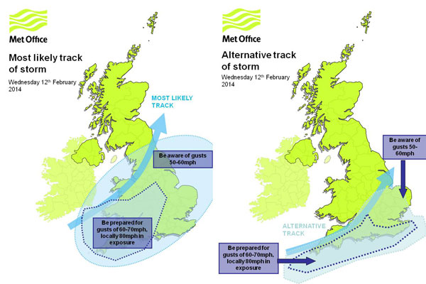
One thing is for sure... Most of the south of England, Wales and the Midlands will feel the affects of Wednesdays storm. The met office have issued Yellow and Amber severe weather warnings of wind, rain and even snow, for much of the UK on Wednesday. The public should be aware of potential disruption to travel and possibly power supplies.
For regular updates visit our Facebook page, click the 'Like' button and then click the 'Follow' button. Updates will then appear in your Facebook news feed.