
The River Kent in Kendal, Cumbria threatens to burst its banks, putting 100s of residential properties at risk of flooding.
Over 1000 homes have been evacuated today (Sunday 15th November 2015) as the Environment Agency issues 6 severe flood warning for the River Kent. A severe flood warning is reseved for the highest risk of flooding, and warns of potential danger to life. If the River Kent bursts its banks as expected, flooding of local residential and business properties is a real risk.
Areas most at risk are...
The critical time for potential flooding is expected to be between 7am and 9am on Sunday morning, but Kendal police have appealed to local residents to leave now, rather than take any risks. The Environment agency say that water levels will be at their highest during this critical time, but flooding could occur earlier.
Update (10.30 am): Reports of 6 flooded properties in Kendal...
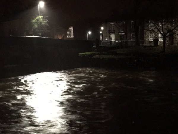
River Kent by Matt Leigh. Environment Agency reported flooding in 6 properties in Kendal. https://t.co/FjaZthexqx pic.twitter.com/PqwgqbHbNV
— BBC Cumbria (@BBC_Cumbria) November 15, 2015
Update (10.30 am): Images on Twitter show water on the river Kent at dangerous levels...
River Kent at 10:00 in #Kendal @gazettenewsdesk @LakelandRadio @TheBayOfficial @CumbriaWeather @EnvAgency pic.twitter.com/hh1zlruco1
— This is my film (@ThisIsMyFilm) November 15, 2015
The River Kent levels still on the increase. Incident Unit now set up in the town centre at Victoria bridge #Kendal pic.twitter.com/vxf5zH0BMW
— Paul Reeves (@PaulReevesEA) November 15, 2015
River Kent in Kendal at 10.30... 3/3 @BBC_Cumbria @CumbriaWeather @LakelandRadio @gazettenewsdesk pic.twitter.com/M1ktzsC9ZD
— mars_stu (@mars_stu) November 15, 2015
The MET office have warned of further prolonged periods of heavy rain on Sunday morning, further increasing the risk of flooding in the North of England.
The public are advised to keep up to date with local weather forecasts, and to use the Environment Agency website to keep up to date with flood alerts and warnings.