Important: The storm has started. We are now providing regular updates on our 'Storm, as it happens' page.
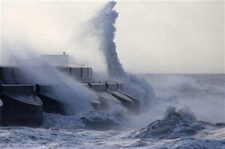
During tomorrow (Monday 23rd December) and Christmas Eve, most of the UK can expect to see Gale force, Strong Gale Force or even Storm Force wind and heavy rain as another deep low pressure system passes close to our shores bringing yet another storm. There is now an Amber weather warning in place for South Wales, South West England and South East England. However, most of the country can expect gale force winds.
When pressure within a weather system falls by 24 millibars in a 24 hour period it is referred to as a Weather Bomb, this low is expected to fall by 50 millibars within a 24 hour period.
Update: Earlier today the Met office took down separate warnings of wind for Monday, combining them with a severe rain warning. After complaints that this was misleading, the Met office reviewed their warnings and and have re-established Yellow warnings of severe wind for tomorrow in the following regions: South and west Wales, South west England, South East England, London and the Western coast of England.
Ensure your friends are aware of the potential severity of this storm by sharing this article on Facebook, Twitter and other social networks (buttons at top).
In the last two weeks a series of deep low pressure systems which have developed over the Atlantic and passed close to the north west of the country bringing storms and disruption. In the last few weeks we have seen high winds, particularly in the north, tidal flooding on the east coast and north Wales, snow in the north and persistent heavy rain which has saturated the ground leaving many areas at serious risk of more floods.
Tomorrow morning heavy rain is expected to affect the south of England and south Wales bringing more risk of local flooding. There are already 2 active flood warnings for the south west and one for the south east. If you are concerned about possible flooding in your area you should look out for flood warnings on the Environment Agency website.
Winds will first reach the south west on Tuesday morning and will affect the rest of the UK as the day goes on. Winds are expected to last well into Christmas Eve, easing from the south later in the day.
Gusts are likely to reach 70mph widely, but particularly in Scotland, Northern Ireland, Wales, north west England and southern England coastal regions. Winds of up to 90mph are possible.
This storm is expected to bring significant disruption to Christmas travel, and possibly damage to trees and property. National rail enquiries have already issued a warning of possible rail disruptions...
Very strong winds and heavy rain are forecast throughout England, Wales and Scotland on Monday 23 December.
This may mean that some trains are delayed or cancelled, and some Train Operators may run an amended timetable.
You can keep up to date with rail disruptions on the National Rail Enquiries service alterations page.
As the storm passes on Christmas eve, more heavy rain is expected to fall, bringing further risk of local flooding.
We will update this page regularly over the next 72 hours and will post regular updates on our Facebook page. Click the 'Like' button and then click the 'Follow' button. Updates will then appear in your Facebook news feed.