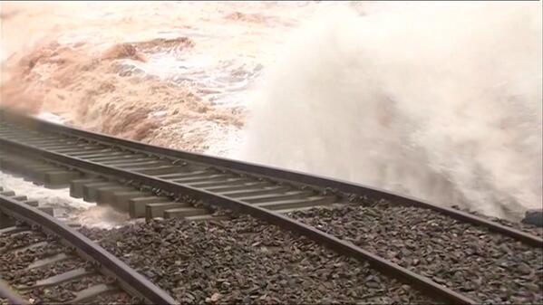
An intense Low pressure weather system will arrive in the UK late on Monday morning (12th Feb 2014), first affecting the south west of England, moving eastwards to affect the whole of England, Wales, and southern parts of Scotland. This storm is expected to be more severe than those seen in recent weeks, and the potential for severe disruption and damage to property is high.
Wind
The Met office have issued an Amber warning of wind for the south west of England, west and north Wales, and northern England. For the rest of England, Wales and southern areas of Scotland, a Yellow severe weather warning of wind is in place. The areas affected by these warnings may change on Wednesday morning.
Update: As expected the weather warnings have been extended. There is now a RED severe weather warning for West Wales and North West England on Wednesday afternoon. And that Amber weather warning ha been extended to include the whole of Wales and the South East of England. Winds of 100mph or more are expected in the RED warning area.
Gusts of 60 - 70mph are expected widely, and 90mph or even more, in exposed areas. Severe gale force winds have the potential to cause damage to property and cause trees to fall. With the ground saturated, we could see a significant number of trees fall on Wednesday, potentially blocking roads, railway lines and damaging power lines.
Wind will also cause more very large waves on the west and south coast. The public are advised to stay away from affected coastal areas where possible.
Rain
The storm will bring more heavy rain to the UK. The Met office have issued a Yellow severe weather warning of rain for the south west of England, the south east of England. south Wales, the East Midlands and southern parts of East Anglia.
15-25 mm of rain are likely within the warning area with a risk of 40 mm on high ground of south Wales and southwest England.
With ground saturated, this further rain is likely to exacerbate the current flooding situation.
Snow
There are two Yellow warnings of Snow for Wednesday. The first for the early hours of the morning, affecting Scotland, north west England, north and west Wales and the East Midlands. And another later in the morning for Scotland when the leading edge of the storm meets with already cold air allowing snow to develop quite widely.
As the warmer air associated with the storm moves in, snow will turn to rain, causing lying snow to rapidly thaw.
Impact
Currently this storm is expected to bring severe gale force winds to much of England and Wales. These winds could bring severe disruption to travel on roads, rail, air and sea. There may also be local disruption to power supplies.
The storm is also likely to bring more problems to flooded areas. The public should keep a close eye on flood warnings issued by the Environment agency.
For regular updates visit our Facebook page, click the 'Like' button and then click the 'Follow' button. Updates will then appear in your Facebook news feed.